Cassino Peak (Lugsangan) — 360° Views Over Cebu
The Climb Up Cassino Peak
After descending Osmeña Peak, a 15-minute motorbike ride brings you to Cassino Peak (officially Lugsangan Peak). The road signs only say “Lugsangan,” which gave me pause at first — but once you know it, just follow them straight ahead.
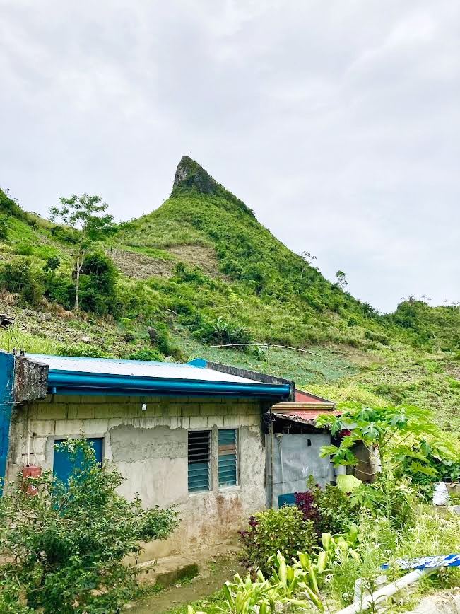
Arriving at the trailhead, I looked up at a summit that jutted into the sky like Switzerland’s Matterhorn. We’re climbing that?
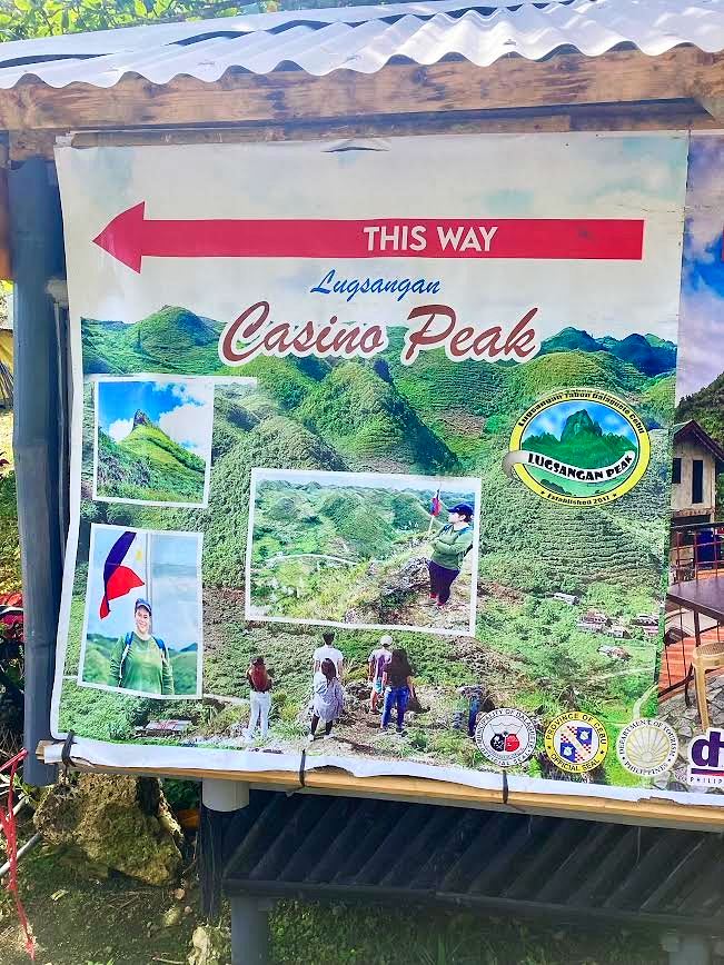
A teenager at the small entrance hut collected the 50-peso entry fee and logged my name in the hiking register. I asked how long it would take to the top. “About 20 minutes,” he said. That seemed fast — but I set off optimistically through the green onion fields. (Spoiler: it took at least 40 minutes. Filipino time is a real thing.)
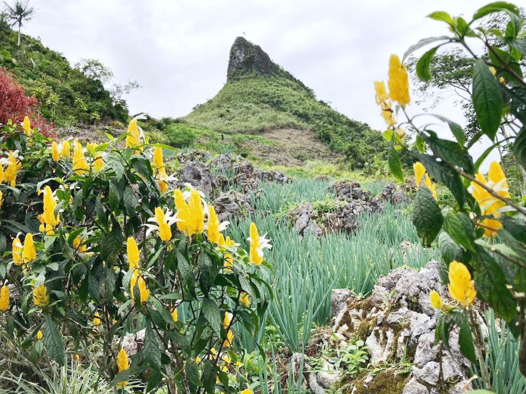
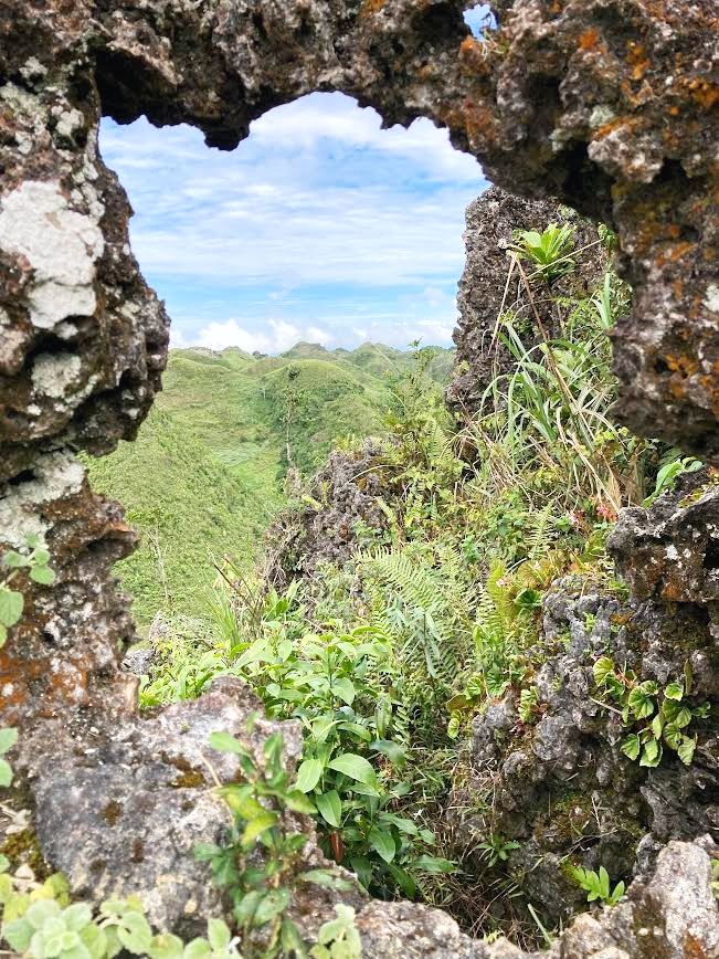
The trail winds through terraces of green onions and carrots growing on surprisingly steep slopes. Volcanic rock forms the path — rough and grippy, which makes the steep sections manageable. Along the way, unusual rock formations and wildflowers keep things interesting.
The Summit
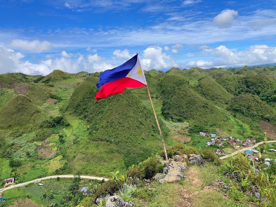
Threading through a narrow gap between two rock faces, the Philippine flag came into view — snapping in the wind. We made it!
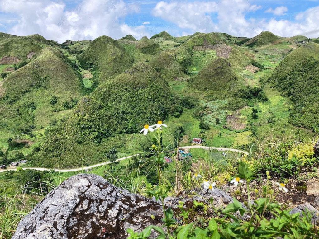
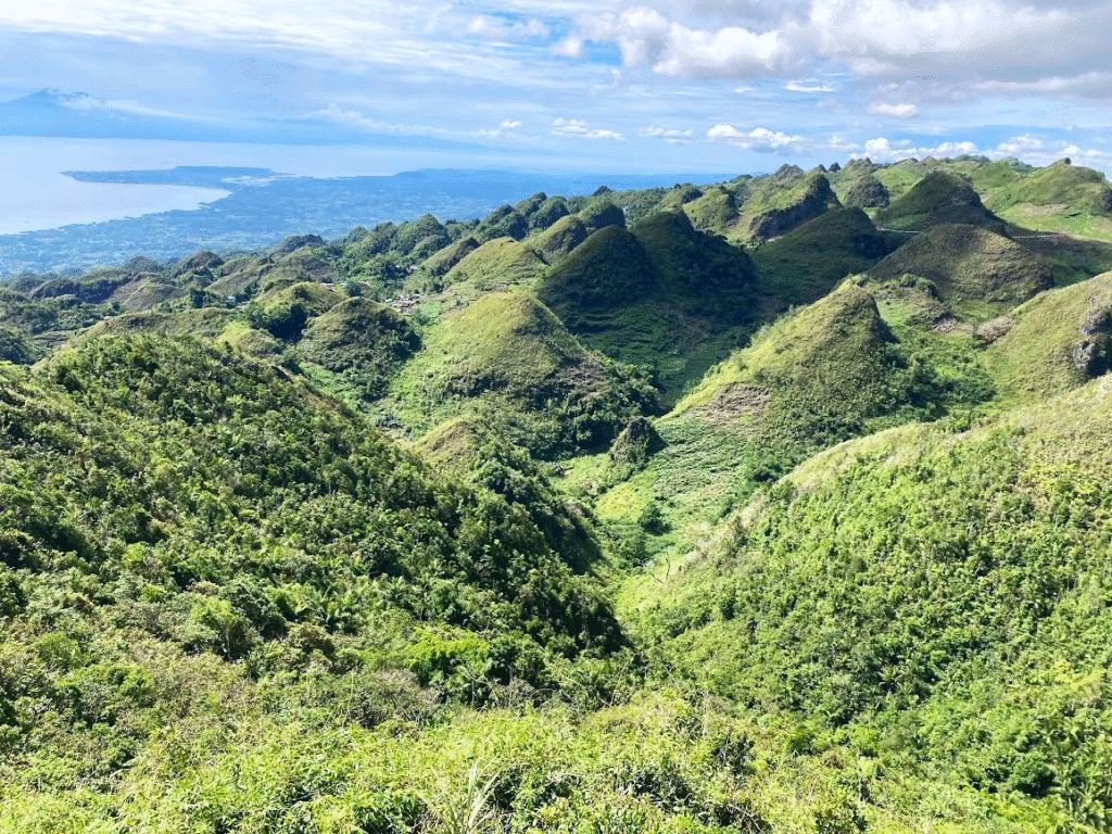
The view is extraordinary. Clear blue sky, blue sea, and green mountains and cabbage fields stretching in every direction. But the defining feature of Cassino Peak is the 360-degree panorama — you can see everything from up here.
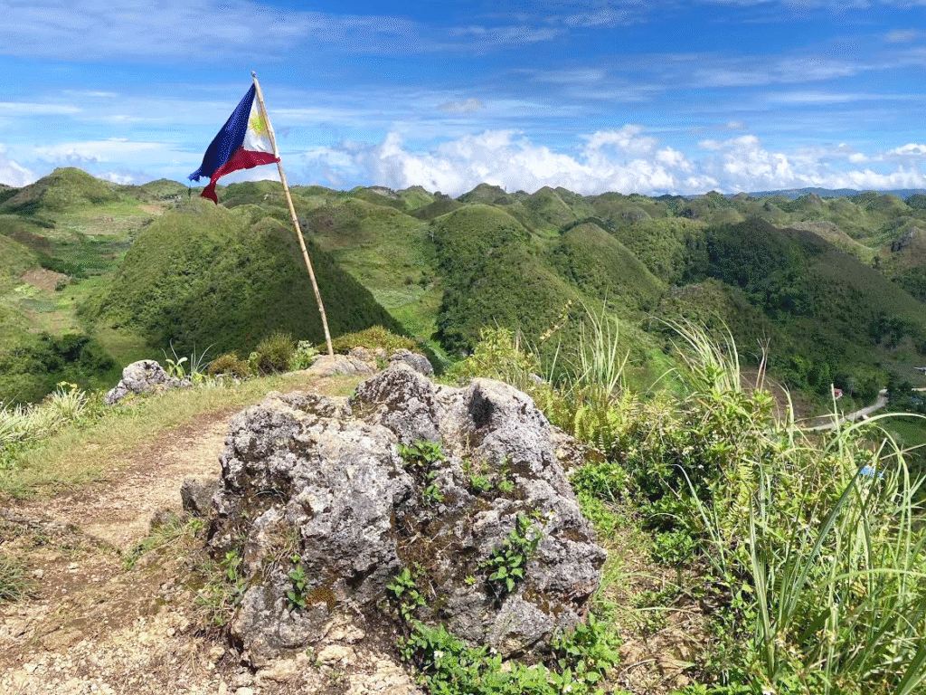
I was so taken by the view that I boiled water, brewed a cup of coffee, and stayed for nearly two hours. A group of Filipinos came up, took their photos, and headed straight back down — leaving me the summit almost entirely to myself. Coffee with a view like that? Unbeatable.
Eventually I had to tear myself away — I had a campsite booked nearby and needed to check in before dark.
Continued in Glamping at Mantalongon Campgrounds…